
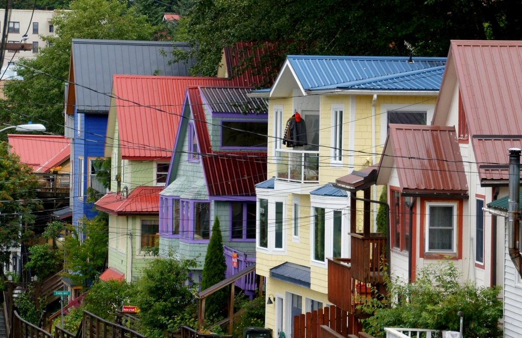
Southeast Alaska is a strip of mainland and more than a thousand islands, about 500 miles (800 km) long, wedged between the Gulf of Alaska and the coast mountains of British Columbia. Most of it is rainforest, most of it is national forest, and almost none of it is connected to anywhere else by road. The channels between the islands are the Inside Passage, a sheltered waterway used by Tlingit canoes for millennia, by gold-rush steamers in the 1890s and today by ferries, fishing boats and very large cruise ships. We think it is the most beautiful way to arrive in Alaska, and also the one that rewards patience most.
Table of Contents
A geography of water
Only three Southeast towns can be reached by car from the rest of the continent: Haines and Skagway at the head of Lynn Canal, and tiny Hyder on the Canadian border. Everything else, including the state capital, is reached by boat or by air. The state ferry system links the towns along the channels, with the longest run starting in Bellingham, Washington and taking a little over a day and a half to reach Ketchikan and around three days to reach Haines and Skagway. Jets connect the larger towns; floatplanes and small aircraft do the rest, landing on harbors, lakes and gravel strips.
The Tongass National Forest surrounds all of it: nearly 17 million acres (6.8 million ha), the largest national forest in the United States and the biggest intact temperate rainforest left on Earth. Sitka spruce and western hemlock grow to 200 feet (60 m), the understory is devil’s club and blueberry, and the rain that feeds it all is measured in feet. Tlingit, Haida and Tsimshian people have lived here for some 10,000 years, and their clan houses, totem poles and languages remain a living part of every community rather than a museum exhibit.
Ketchikan, the first port and the wettest
Ketchikan is the southern gateway, 90 minutes by air from Seattle, and it announces itself with rain: about 150 inches (3,800 mm) a year, four times what Seattle gets. The town is built on stilts and staircases along Tongass Narrows, with Creek Street, its former red-light district, hanging over the salmon stream that gave the town its name. Ketchikan has one of the largest collections of standing totem poles anywhere, in parks either side of town and a downtown heritage center, and they are the best introduction to the crest art of the coast. To the east lies Misty Fjords National Monument, 2.3 million acres (930,000 ha) of granite walls rising 3,000 feet (900 m) straight out of the sea, reached by floatplane or a long boat day.
Sitka, facing the open ocean
Sitka is the one Southeast town that looks out on the Pacific rather than into a channel, on the west side of Baranof Island with the volcanic cone of Mount Edgecumbe, 3,201 feet (976 m), across the sound. It was the capital of Russian America under the name New Archangel, and the transfer of Alaska to the United States was signed on Castle Hill in October 1867. The Russian legacy is a green-domed cathedral, a bishop’s house and an old cemetery, but the deeper story is Tlingit. Sitka National Historical Park preserves the site of the 1804 battle in which the Kiks.adi clan held off the Russians for days before withdrawing, and its forest trail passes a series of totem poles beside the Indian River. The town is small enough to walk, and the waters around it are the best place on the coast to see sea otters, which were hunted almost to extinction here and have returned in their thousands.
Juneau, a capital without a road out
Juneau has about 32,000 people, a legislature and no road to anywhere. Its streets climb steeply from the waterfront, and Mount Roberts and Mount Juneau rise more than 3,500 feet (1,070 m) directly behind the state office buildings. The Juneau Icefield, 1,500 square miles (3,900 sq km) of ice on the border with Canada, feeds dozens of glaciers, and the most famous of them, Mendenhall, ends in a lake about 13 miles (21 km) from downtown, reached by city bus. Trails run to a waterfall beside the ice, to the West Glacier viewpoint and around the East Glacier loop, and in winter, when the lake freezes, walkers cross to ice caves that change every year. The glacier has retreated well over a mile since the 1950s; the markers along the shore are hard to argue with.
The town is also the busiest cruise port in the state, with more than 1.6 million ship passengers in a recent summer, and on a five-ship day downtown is packed. We walk out of it: the Perseverance Trail into the old mining valley, the steep climb up Mount Roberts, or a bus ride north along the road to its end at Echo Cove, 40 miles (64 km) out, past beaches where humpback whales feed within sight of the shore. Tracy Arm and Endicott Arm, two fjords south of the city with tidewater glaciers at their heads, are a full day by boat and worth it.
The northern end: Skagway, Haines and Glacier Bay
At the top of Lynn Canal, the deepest fjord in North America, sit Skagway and Haines, 15 miles (24 km) apart by water and about 360 miles (580 km) apart by road through Canada. Skagway is the 1898 gold-rush town preserved almost intact, and the start of the 33-mile (53 km) Chilkoot Trail over the pass into British Columbia, a three to five day walk that follows the stampeders’ route and requires a permit. Haines is quieter, with a river valley where several thousand bald eagles gather on the Chilkat flats in November. To the west, Glacier Bay National Park covers 3.3 million acres (1.3 million ha) of a bay that was solid ice 250 years ago; the glaciers have retreated 65 miles (105 km) since then, and boats from the small settlement of Gustavus run to their faces past whales, seals on the floes and mountain goats on the cliffs.
Planning for a coast that runs on weather
May and June are the driest months and September the wettest of the season; rain falls on roughly two days in three over the year, so the trick is to stop waiting for it to stop. Waterproof boots, a hooded shell and a willingness to walk in drizzle turn the rainforest from a nuisance into the whole point. Ferries and small planes are cancelled by fog and wind, and a missed connection can cost two days, so we leave buffer days at either end and never book a flight home for the same day as a ferry arrival. Costs run high in summer for rooms and boat trips, lower on the ferry itself, where a deck chair under the heat lamps and a sleeping bag are a time-honored bed. Above all, the coast is home: ask before photographing people or clan property, stay off private and tribal land without permission, and expect to be welcomed if you do.