
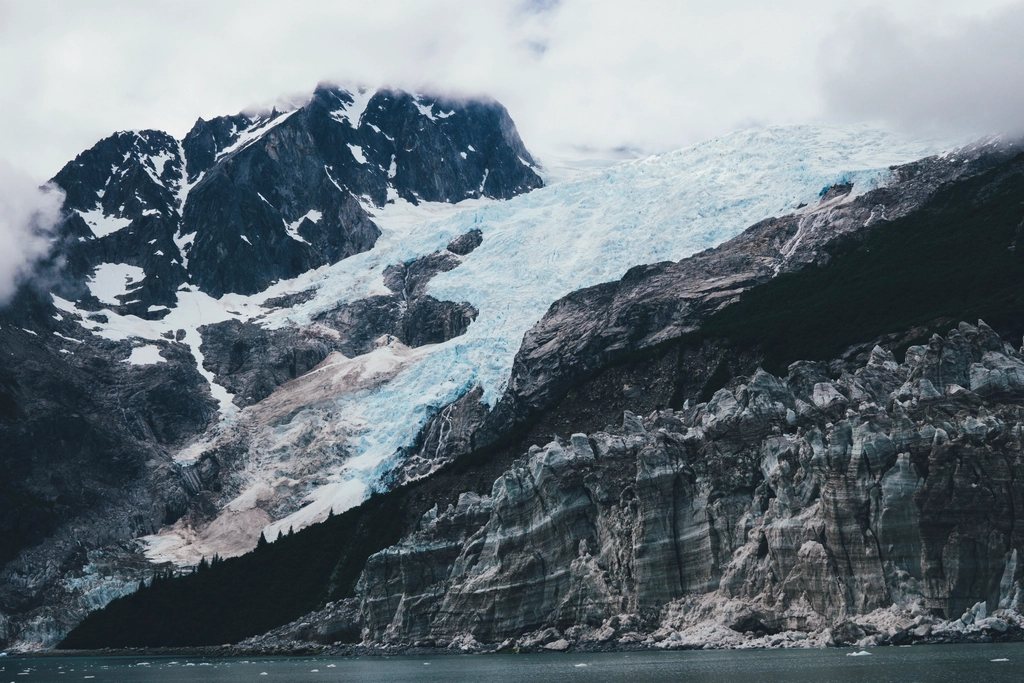
If Alaska had to be reduced to a single long weekend, most of us would spend it on the Kenai Peninsula. It hangs off the bottom of Southcentral Alaska like a thumb, roughly 150 miles (240 km) long, and it packs an icefield, two very different harbor towns, a river the color of glacier milk and a coastline of fjords into a space you can drive across in an afternoon. It is also busy, and we want to be honest about that.
Table of Contents
Leaving Anchorage on the Seward Highway
The peninsula begins where the Seward Highway leaves Anchorage and runs south along Turnagain Arm. For 40 miles (64 km) the road is squeezed between the Chugach Mountains and a tidal inlet that empties almost completely twice a day, exposing gray mudflats that are dangerous to walk on. Bore tides push up the Arm on the biggest tide days, Dall sheep graze the cliffs above the road at Windy Corner, and beluga whales follow the salmon in late summer. Past the head of the Arm the road climbs over Turnagain Pass at about 1,000 feet (300 m), then drops to Tern Lake, 90 miles (145 km) from Anchorage, where the highway splits. Straight on lies Seward, 37 miles (60 km) away; to the right, the Sterling Highway begins its long westward run to Homer.
Seward and the edge of Kenai Fjords
Seward sits at the head of Resurrection Bay, 127 miles (204 km) from Anchorage by road and also reached by rail and by the state ferry. It is a working port with a small-town grid, a waterfront campground and, every Fourth of July, a race that sends runners straight up to a 3,022-foot (921 m) point on the mountain behind town and back down again. Most visitors come for Kenai Fjords National Park, which protects the Harding Icefield, roughly 700 square miles (1,800 sq km) of ice with more than 30 glaciers flowing out of it. Only one of them, Exit Glacier, can be reached by road: a paved spur ends at a ranger station about 12 miles (19 km) from town, and a gentle path leads toward the glacier’s edge past signs marking where the ice stood in past decades. From the same trailhead the Harding Icefield Trail climbs about 3,500 feet (1,070 m) in 4.1 miles (6.6 km) to a viewpoint over the ice; allow six to eight hours for the round trip and expect snow on the upper trail into July.
The rest of the park is water. Day boats leave Seward’s small-boat harbor for the outer bay and the fjords beyond, and a full day takes you into Aialik Bay or Northwestern Fjord, where tidewater glaciers calve into the sea and sea otters, puffins, sea lions and humpback whales are a normal part of the trip. The open water around Cape Resurrection can be rough, so a shorter bay cruise is a fair choice for anyone who does not like swell.
Cooper Landing and the Kenai River
Back at Tern Lake, the Sterling Highway heads west along Kenai Lake and into Cooper Landing, where the Kenai River leaves the lake in a color that first-time visitors find hard to believe. The turquoise comes from glacial flour suspended in the water, and in June and July it carries some of the most sought-after sockeye salmon runs in the state. Where the Russian River joins the Kenai, the confluence fills with anglers standing shoulder to shoulder in a style locals call combat fishing. Regulations change by species, river section and week, so anyone planning to fish should read the current rules before buying a license. Bears fish here too; the trails along the Russian River are posted for a reason, and keeping fish in the water on a stringer and cleaning them only at the designated stations are not optional habits.
The Kenai National Wildlife Refuge covers nearly 2 million acres (780,000 ha) of the peninsula’s interior, and the Skilak Lake Loop, a gravel road south of the highway, is the easiest way into it. Short trails climb to Skilak Lookout and Hidden Creek, moose are common, and the refuge’s lakes are the peninsula’s canoe country, with two marked multi-day canoe systems.
Soldotna, Kenai and the west coast
The highway reaches Soldotna at mile 95, and beyond it the river towns flatten out into a broad coastal plain. The city of Kenai, on the bluffs where the river meets Cook Inlet, keeps a small Russian Orthodox church from the 1890s and a view across the inlet to the volcanoes of the Aleutian Range: Redoubt, Iliamna and, far to the south, Augustine. In July the mouth of the river fills with Alaska residents dipnetting for salmon, a personal-use fishery closed to visitors but fascinating to watch from the beach. South of Kenai the Sterling Highway follows the coast through Ninilchik, an old Russian-era village with a hilltop church, and Anchor Point, the westernmost place on the North American road system, where boats are launched by tractor straight off the beach.
Homer and Kachemak Bay
The road ends at Homer, about 220 miles (354 km) from Anchorage, on a bluff above Kachemak Bay with the glaciers of the Kenai Mountains lined up across the water. The town’s signature is the Spit, a 4.5-mile (7.2 km) gravel finger reaching into the bay, lined with a harbor, campgrounds and charter offices. Homer calls itself a halibut capital and earns it; day charters run from the Spit all summer, and the fish can weigh more than 100 pounds (45 kg). The finer prize, to our minds, is Kachemak Bay State Park on the far shore, reachable only by water taxi. A short crossing lands you at the trailhead for Grewingk Glacier Lake, an easy walk of a little more than 3 miles (5 km) each way to a lake full of icebergs, and longer trails climb to alpine ridges above Halibut Cove.
Practical notes for the peninsula
Distances on the peninsula are modest by Alaska standards, but summer traffic is not. The Seward Highway is two lanes for most of its length, and Friday afternoons out of Anchorage and Sunday evenings back can double drive times. We plan the loop over five days at a minimum: two nights in Seward, one in Cooper Landing or on the Kenai River, and two in Homer. Weather is maritime; expect rain on the coast even in July and pack for 50 degrees Fahrenheit (10 C) with wind on the water. Campgrounds, public-use cabins and boat trips all fill from mid-June to mid-August and are best reserved months ahead, while May and September bring emptier roads, lower prices and, in September, the first snow on the peaks. The peninsula is home to Dena’ina and Alutiiq people whose place names and fishing traditions are older than any highway; the small museums in Kenai and Homer are good places to start understanding whose land this is.