
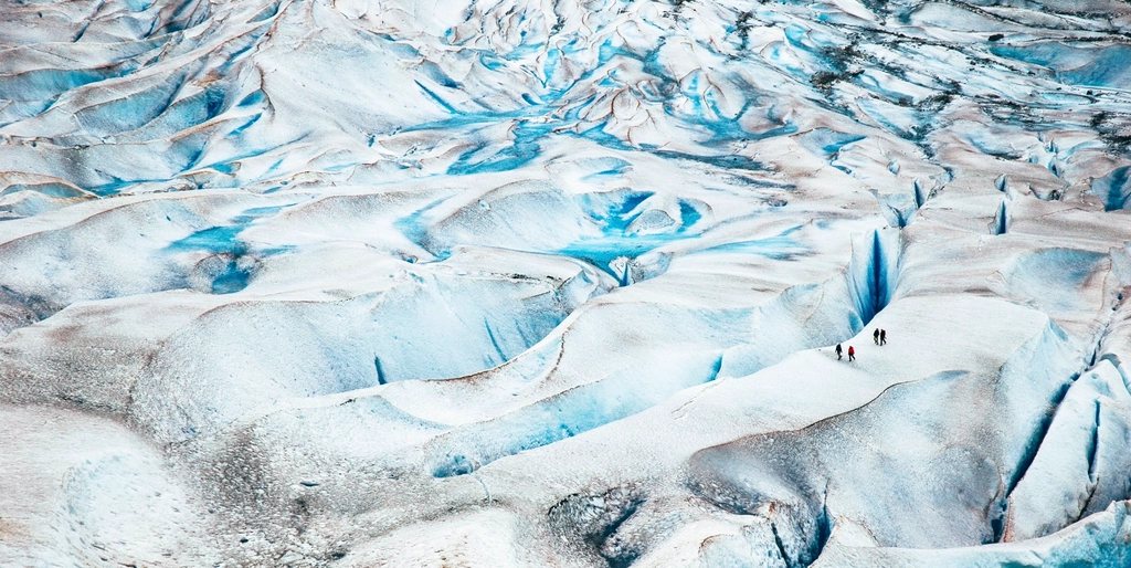
Alaska holds something like 100,000 glaciers, and three of them can be reached in a day from a paved road without a helicopter or a boat charter. Matanuska sits beside the Glenn Highway northeast of Anchorage, Exit Glacier is a short drive from Seward on the Kenai Peninsula, and Mendenhall is practically a suburb of Juneau. We have walked on, beside and under all three, and the more time we spend near ice, the more we respect how alive it is. This is a guide to seeing them well, and a short course in why glaciers do what they do.
Table of Contents
Matanuska: the river of ice beside the highway
Matanuska Glacier is about 27 miles (43 km) long and roughly 4 miles (6.4 km) wide at its terminus, which makes it the largest glacier in the United States that you can drive to. The viewpoint lies near mile 100 of the Glenn Highway, about 100 miles (160 km) from Anchorage, a drive of two to two and a half hours through the Matanuska River valley with the Chugach on one side and the Talkeetnas on the other. From the state recreation site above the road, the ice looks close enough to touch; in truth, the gravel plain in front of it is a mile wide and full of channels.
Access to the ice itself crosses private land, and in recent years walking on the glacier has been allowed only with a guide. That is not a marketing arrangement; it is a response to people falling into moulins and crevasses. On a guided walk you will be fitted with crampons and led across the white ablation zone, where the surface is firm, and shown the blue pools, the ice caves that open and collapse within weeks, and the seracs that sound like distant artillery when they shift. Expect to be out for two to four hours, and to be surprised by how warm it feels on a sunny day with all that white reflecting upward.
Exit Glacier: a walk through the years
Exit Glacier is the only part of Kenai Fjords National Park you can reach by road. It lies about 12 miles (19 km) from Seward at the end of Herman Leirer Road, and it drains the Harding Icefield, a plateau of ice roughly 700 square miles (1,800 square km) in size that feeds nearly 40 glaciers. The approach is a lesson in retreat. Along the road and the trail, small signs mark the year the terminus stood at that spot: 1815, 1899, 1926, 1951, and so on, until the signs from the 2000s come one after another in the last few hundred yards. In the past two decades the glacier has pulled back on average well over 100 feet (30 m) per year.
The Glacier View loop is about a mile (1.6 km) and flat. The Edge of the Glacier trail climbs a little farther to the moraine below the ice; walking onto the glacier from here is prohibited, and the outwash plain is closed when the terminus is unstable. The real prize is the Harding Icefield Trail: 8.2 miles (13.2 km) round trip with about 3,500 feet (1,070 m) of gain, from cottonwood forest through alder and heather to a lookout where the icefield stretches to the horizon like a white sea. Six to eight hours is a fair estimate, and snow covers the upper trail into July.
Mendenhall: Juneau’s glacier and its lake
Mendenhall Glacier is about 13 miles (21 km) long and ends in Mendenhall Lake, roughly 12 miles (19 km) from downtown Juneau in the Tongass National Forest. It is part of the Juneau Icefield, which covers about 1,500 square miles (3,900 square km) and spills into British Columbia. Since the early twentieth century the terminus has retreated well over a mile and a half (2.5 km), and the lake exists only because the ice left the space behind.
The Nugget Falls trail, about 2 miles (3.2 km) round trip, brings you to a waterfall crashing onto the beach beside the ice with the glacier face a few hundred yards away. The West Glacier Trail, about 3.4 miles (5.5 km) one way, climbs rock and root to viewpoints above the ice and is the route used to approach the glacier on foot with proper equipment. Paddlers cross the lake on calm mornings and idle among stranded bergs, keeping a wide margin from the face, because a calving event sends a wave across a lake that is only a few degrees above freezing.
How ice actually behaves
A glacier is a river that moves so slowly we mistake it for a landscape. Snow accumulates in the high basin, compresses into dense ice over decades, and flows downhill under its own weight at anywhere from a few inches to several feet a day. Where the ice bends over a bump in the bedrock, the brittle surface cracks into crevasses, sometimes hidden by a bridge of snow. Where meltwater finds a crack, it drills a moulin, a vertical shaft that can drop hundreds of feet to the bed.
The blue color is not a trick of the sky. Dense ice absorbs the red end of the spectrum and lets blue escape, so the older and more compressed the ice, the deeper the color. The gray-brown milk in every glacial river is rock flour, stone ground to powder by the moving ice, and it hides the depth of any channel completely. Where a glacier meets the sea, as in Prince William Sound or Glacier Bay, the face calves in blocks the size of houses. The sound arrives after the splash, and the wave arrives after the sound. Half a mile (800 m) is the usual minimum distance, and we treat it as a floor, not a target.
Staying safe near the ice
Our short list for any glacier day:
- Never step onto ice alone or without crampons and a rope; the surface that looks solid is often a snow bridge over a crevasse.
- Stay out of ice caves unless a guide has checked them that morning; they collapse without warning, most often in warm weather.
- Keep well back from calving faces on land and on water, and keep out of the outwash plain when the terminus is unstable.
- Treat every meltwater stream as deeper and colder than it looks; the silt makes depth invisible.
- Bring sunglasses and sunscreen even under cloud; the glare off ice burns skin and eyes fast.
- Dress for the wind, because glaciers make their own, flowing cold air downslope on the sunniest afternoon.
Seeing the ice in its season
Late May through September is the reliable window for the roads and trails described here, with July and August warmest and busiest. Early September brings fewer people, crisp light and the first dusting on the icefields. We like to arrive early in the day, when the air is still and the meltwater channels are lowest, and to sit for a while. Ice does not perform on demand, but if you stay long enough, it always says something.