
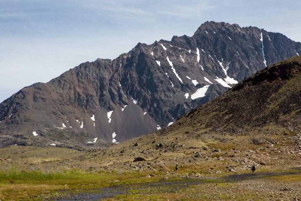
An hour north of Anchorage the Chugach Mountains step back, the Glenn and Parks Highways part company and the land opens into the broad farmed floor of the Matanuska-Susitna Valley. Everyone calls it the Mat-Su. It is the fastest growing part of Alaska, a valley of hayfields, subdivisions and enormous cabbages, and it is also the doorway to three things we rate among the best in the state: the alpine bowl of Hatcher Pass, the glacier-fed wilderness of the Knik River, and the small river town of Talkeetna, where the biggest mountain on the continent shows itself across the water on a clear day.
Table of Contents
Two rivers, two highways, one valley
The valley is named for its rivers. The Matanuska comes down from the east, out of a glacier of the same name, and the Glenn Highway follows it; the Susitna comes from the north, out of the Alaska Range, and the Parks Highway follows that. The two roads split at a junction 35 miles (56 km) from Anchorage, and the valley’s two towns sit just beyond: Palmer on the Glenn, laid out in 1935 when the federal government moved about 200 farm families from the Midwest here as a Depression-era colony, and Wasilla on the Parks, the valley’s commercial sprawl. Palmer still looks like a farm town, and for the last two weeks of August it hosts the state fair, where the cabbage weigh-off has produced heads of more than 130 pounds (60 kg) grown under twenty hours of daylight. The Dena’ina and Ahtna Athabascan peoples fished and traded here long before any of this, and the names Knik, Matanuska and Susitna are all theirs.
Hatcher Pass: the valley’s high country
A paved road climbs north from Palmer up the Little Susitna River into a treeless bowl of granite peaks at about 3,500 feet (1,070 m). The centerpiece is a state historical park around the remains of a hard-rock gold mine that ran from the 1930s until 1951: bunkhouses, a mill and tunnel mouths in a setting so open that marmots whistle at you from the tailings. Short trails leave from the park to Gold Cord Lake, 1.6 miles (2.6 km) round trip, and to the pass itself; a longer one climbs the Reed Lakes valley, 9 miles (14.5 km) round trip through a boulder field to two turquoise lakes below the hanging glaciers of the Talkeetna Mountains.
The road continues over the pass summit at 3,886 feet (1,184 m) and down some 30 miles (48 km) of gravel to Willow on the Parks Highway, a loop we recommend on any clear afternoon. The upper section is open only from about early July to mid-September, depending on snow; the rest of the year the road ends near the mine turnoff, and the bowl becomes one of the busiest backcountry ski and snowmachine areas in the state, with real avalanche terrain. Weather changes fast up here; we have walked out of July sunshine into sleet in twenty minutes.
The Knik and the Matanuska: two glaciers, two moods
South of Palmer the Knik River comes out of the mountains in a gravel plain a mile (1.6 km) wide, fed by the Knik Glacier, a 25-mile (40 km) tongue of ice that once dammed a lake so large its annual outburst floods swept the valley until the 1960s. There is no road to the ice. The last miles are river bar and braided channel, and people reach the glacier face and its iceberg lagoon by airboat, on fat-tire bikes and ATVs in low water, or by helicopter, all arranged locally. Above the river stands Pioneer Peak, 6,398 feet (1,950 m), the wall of rock that dominates every view from Palmer; a gentler walk climbs Bodenburg Butte, a 900-foot (275 m) hill in the farmland with a view over the whole valley.
The Matanuska Glacier, up the Glenn Highway about 100 miles (160 km) from Anchorage, is the opposite kind of place: 27 miles (43 km) long, 4 miles (6 km) wide at its foot and reachable by car. The land at its terminus is private, so walking on the ice is done with a guide and a fee; there is also a state recreation site and highway pullouts a mile or two east with a fine free view of the whole ice river.
Talkeetna and the mountain
Fourteen miles (23 km) up a spur road from the Parks Highway, about 115 miles (185 km) north of Anchorage, Talkeetna sits at the confluence of the Talkeetna, Chulitna and Susitna rivers. It is a town of a few hundred people, a main street of log buildings from the railroad days, a summer train stop and a gravel airstrip that is one of the busiest in the state. That airstrip is the key. Every climber attempting Denali registers at the ranger station here and flies from this strip to the base camp on the Kahiltna Glacier at 7,200 feet (2,200 m); roughly 1,000 to 1,200 people a year make the attempt, most of them in May and June. Non-climbers can fly too, on flightseeing trips that circle the summit and, weather allowing, land on a glacier in the Ruth Gorge, where granite walls rise nearly a mile (1,500 m) from the ice.
The view from the ground is the thing we come for. Walk to the end of Main Street, cross the railroad tracks and stand on the river bar, and Denali sits at the head of the Susitna valley about 60 miles (97 km) away, with Foraker and Hunter beside it. From here you see the south face: the whole 18,000-foot (5,500 m) rise from the lowlands, the Cassin Ridge and the Kahiltna, the side that is usually clearest because the mountain’s own weather piles up on the north. Odds are perhaps one clear day in three, better in early morning and in late summer; when it is out the whole town seems to stop to look.
Denali State Park: the southern viewpoints
North of Talkeetna the Parks Highway climbs through Denali State Park, 325,000 acres (130,000 ha) of forest and ridge that most travelers drive straight through on their way to the national park. The pullout at mile 135, the South Viewpoint, has the classic postcard view; Byers Lake at mile 147 has a campground, a lakeshore loop and public-use cabins; and the K’esugi Ridge trail, 27 to 36 miles (43 to 58 km) depending on the trailheads, is a two to four day walk along the crest of a tundra ridge with the whole Alaska Range across the valley. It is our favorite backpacking trip in Southcentral, bear country all the way, with weather that can pin you in a tent.
Practical notes
The Mat-Su is an easy day trip from Anchorage and a better two or three, with Palmer or Talkeetna as a base. Roads are paved and fuel is everywhere; watch for moose on the Parks Highway at dusk. June has the longest days and the freshest snow on the peaks; late August, when the fair is on, the blueberries are ripe and the birch begins to turn, is the local favorite. Costs are lower than in Anchorage or Seward for rooms and food, and higher for anything with a rotor or a propeller; flightseeing is the single most expensive hour of an Alaska trip and, when the mountain is out, the one nobody regrets.